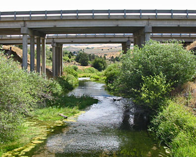
Portneuf Above Marsh Ck Looking North.
|
Location:
|
Latitude N: 42.782320331
Longitude W: -112.230441791
Elevation:
Bannock County, Idaho, on the downstream side of a private residential bridge near river mile 33 and 50 ft downstream of the Interstate 15 crossing, 1 mi south of Inkom. |
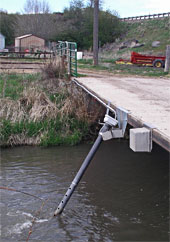
Equipment:
|
YSI 5920 multiparameter water quality sonde with temperature, specific conductance, pH, dissolved oxygen, and turbidity
|
Period of Record:
|
27 July 2003 – present during ice free conditions |
|
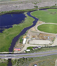
Monitoring station is to the left of red barn downstream from I-15 South bridges.
|