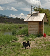
Gage house contains a stilling well and recording-telemetry equipment.
|
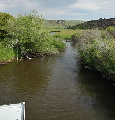
Location:
|
Latitude N: 42.782005269
Longitude W: -112.237091747
Elevation:
Bannock County, Idaho, on upstream side of a private pedestrian bridge, 100 feet east of Marsh Creek Road, 0.5 mi west of Interstate 15, 5 mi south of Inkom and 6 mi north of McCammon. |
Equipment:
|
YSI 5920 multiparameter water quality sonde with temperature, specific conductance, pH, dissolved oxygen, and turbidity
|
Period of Record:
|
13 July 2003 – present during ice free conditions |
|
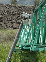
The hinge-mounted pipe suspends and protects water quality probes.
|